Carrie Furnaces
Our job as a class is to propose a plan for the site that would make Carrie more accessible to the public and illustrate a clear vision in terms of its function, layout, and relationship to the community. My individual project revolved around bringing people into the site and to the surrounding communities through development of a community bike path that runs through the site and along the adjacent river.
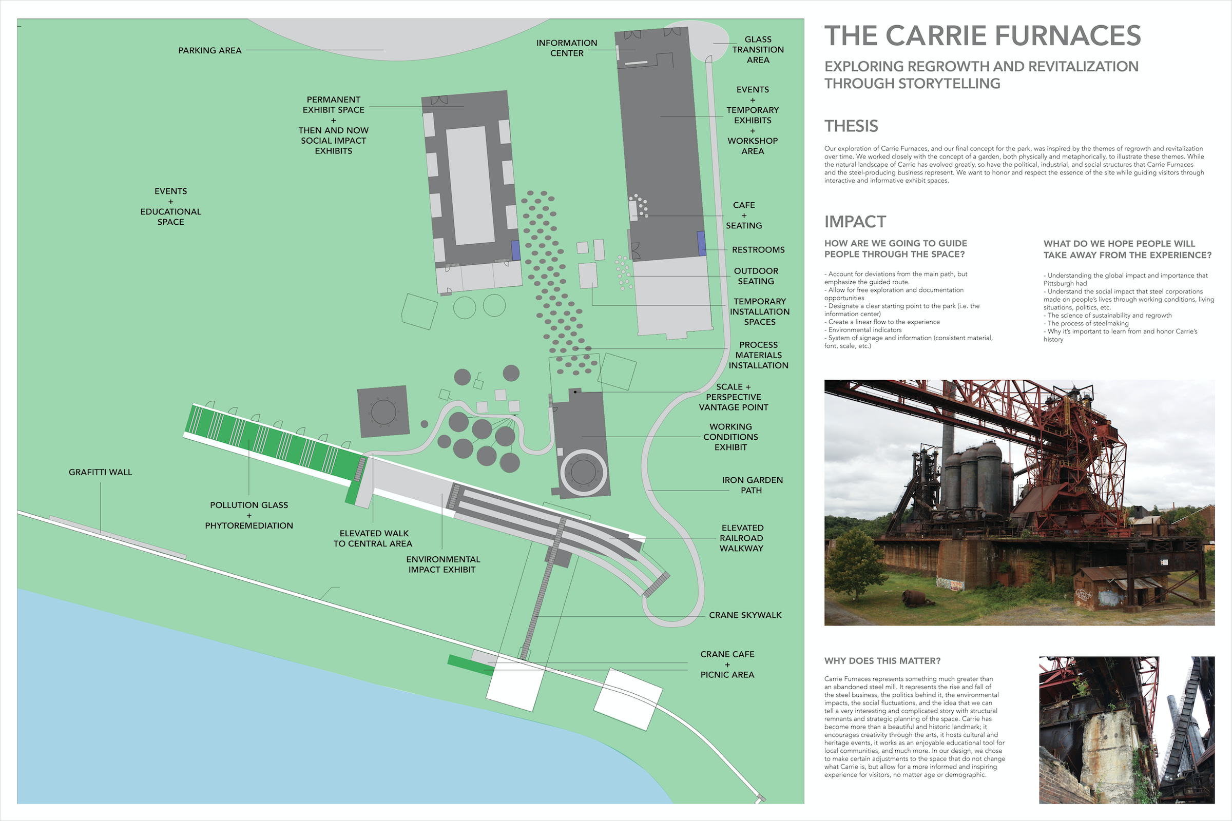
The goal of the project is to design Carrie Furnaces, an abandoned steel mill now run by a non-profit organization, as an industrial park that will allow for more public access and freedom. Currently the site is very closed off from the community; there is one main access point that is not apparent and the site is mostly comprised of guided tours during the day and local events on the weekends.
Skills
Rendering + Charrette + Wayfinding + Scale model visualizations + Booklet design + Geo-historical research + Collaboration + Ai + SketchUp + Moodboards
Carrie Furnaces, Rankin, PA
Exploring + Researching Carrie
making steel, and some about the social and cultural issues that emerged and developed in and around Carrie Furnaces. We finished our research phase with group exercises of mapping out Carrie and visualizing where possible interventions could take place (left). Combined, these research phases helped us to better understand and respect the site for what it is now and where we see it growing and developing into, through individual projects and interventions.
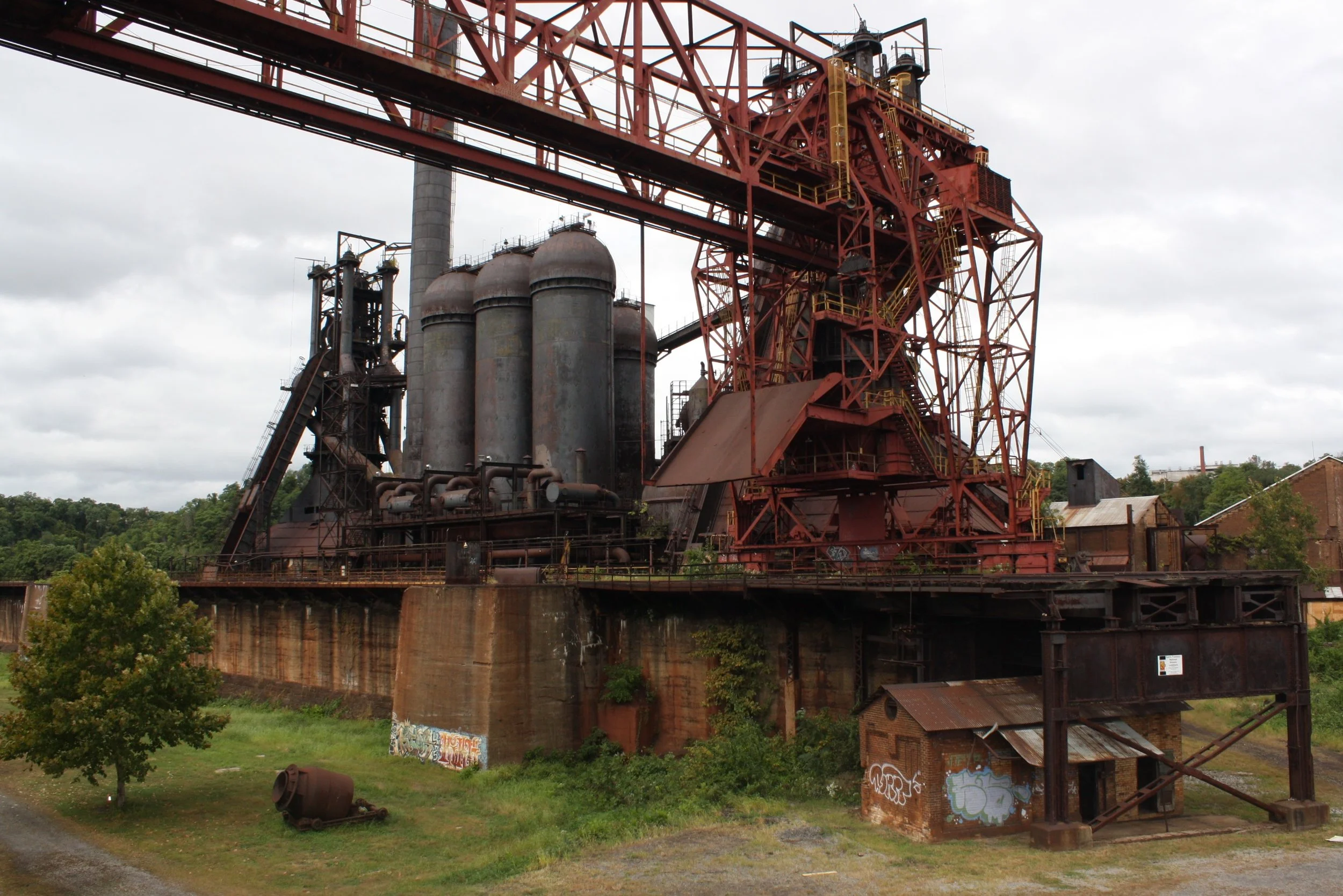
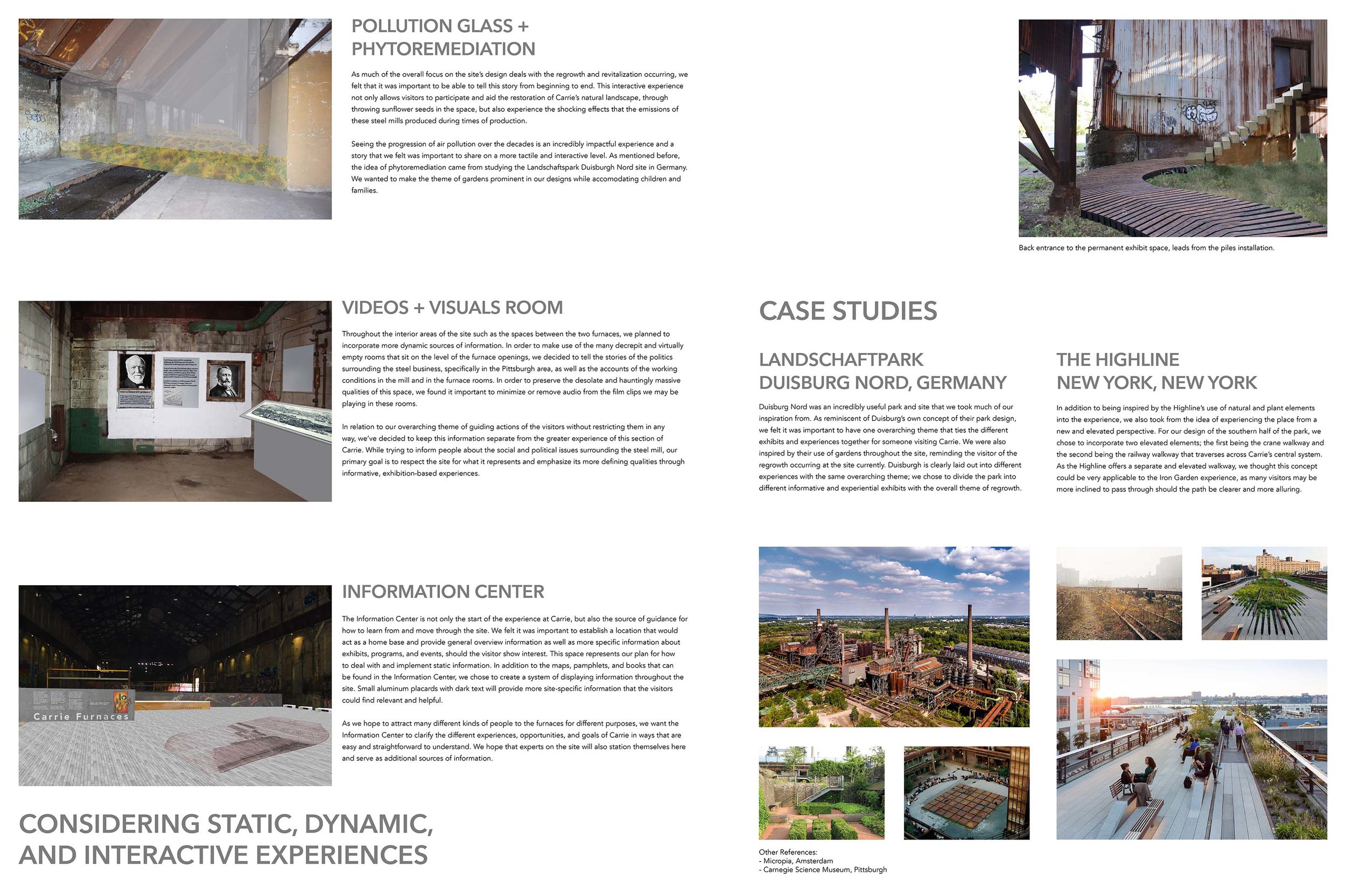
As a class, we did a considerable amount of research before actually undertaking any kind of site plan or overall concept for the park. Visiting the Carrie Furnaces site (top right of image below) was incredibly useful, as I was able to gain an understanding of the scale, the history, and the many visceral responses I had while being there, both alone and on the guided tour. We then made small boards that researched individual stories of Carrie (bottom right); some about the history of Pittsburgh steel, some about the processes of

Pair Charrettes- Developing an Initial Vision
In order to gain more insights into what interventions and plans would be most effective and enjoyable at Carrie, we split up into three groups of two and created a site plan with our thesis, goals, and interventions visualized on 24 by 36 inch boards. My approach with Ty veered more on the educational and guided side of the spectrum. We were particularly inspired by the environmental impacts of the steel industry, and worked on how we could illustrate these interventions in various parts of the site.
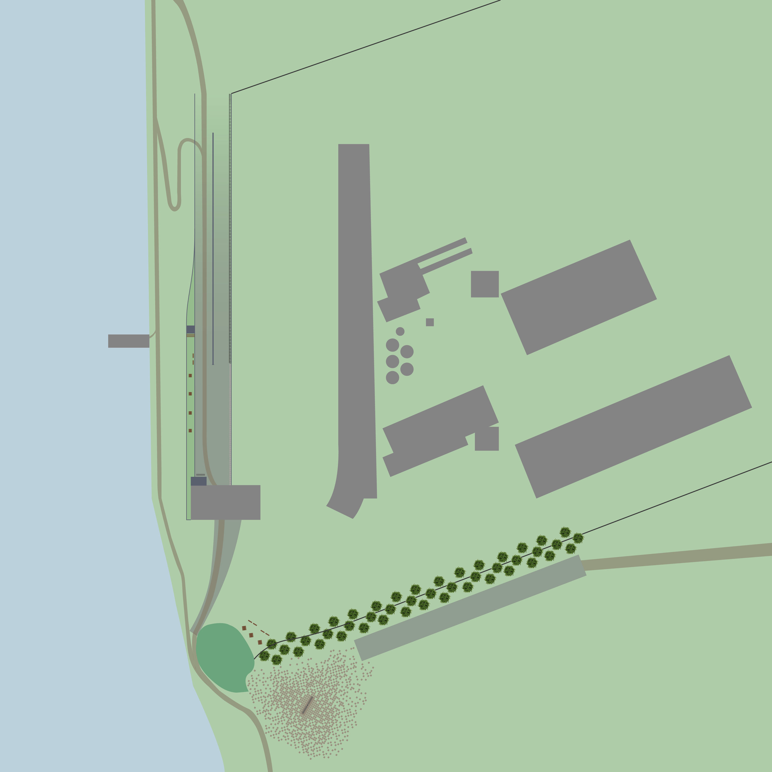
Final Site Plan for Carrie Furnaces
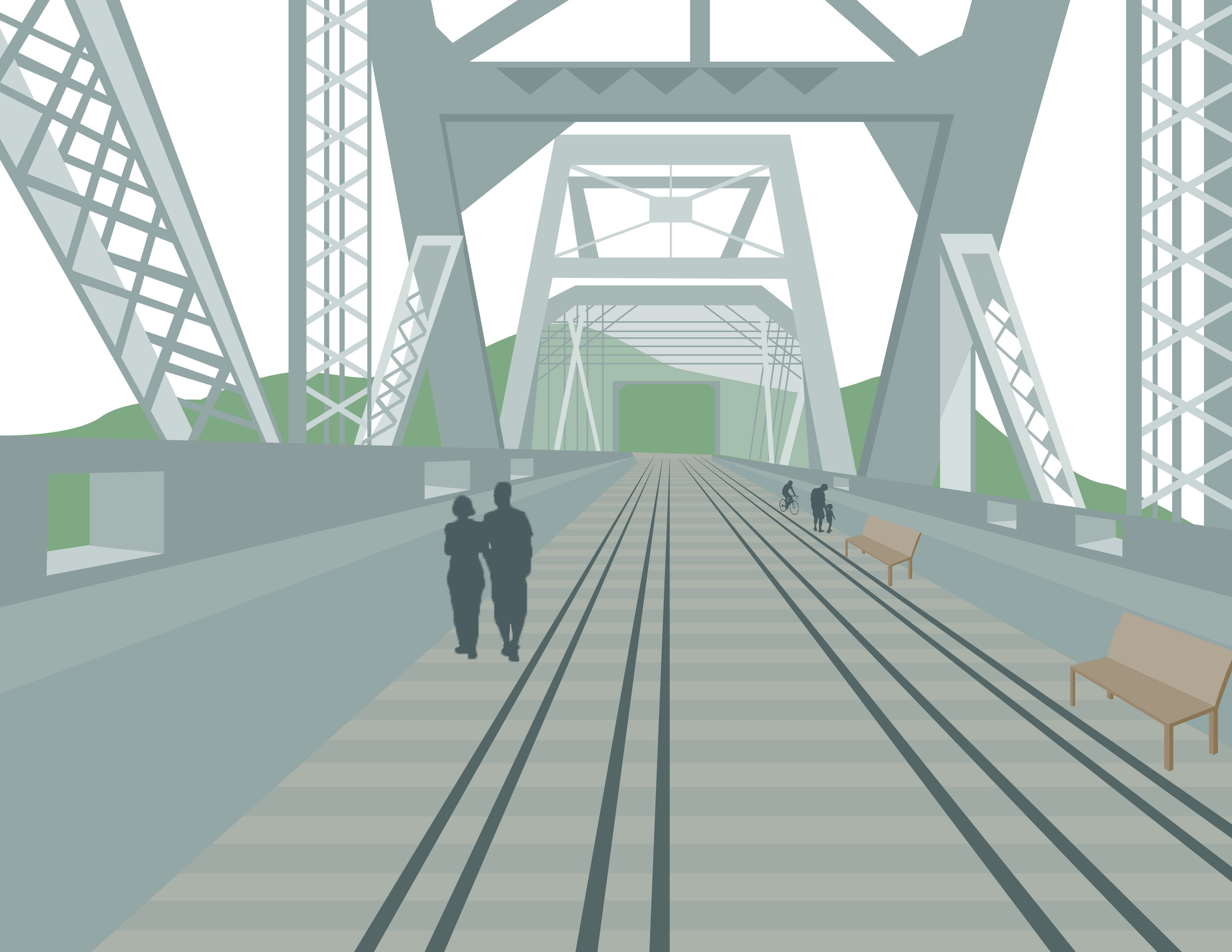
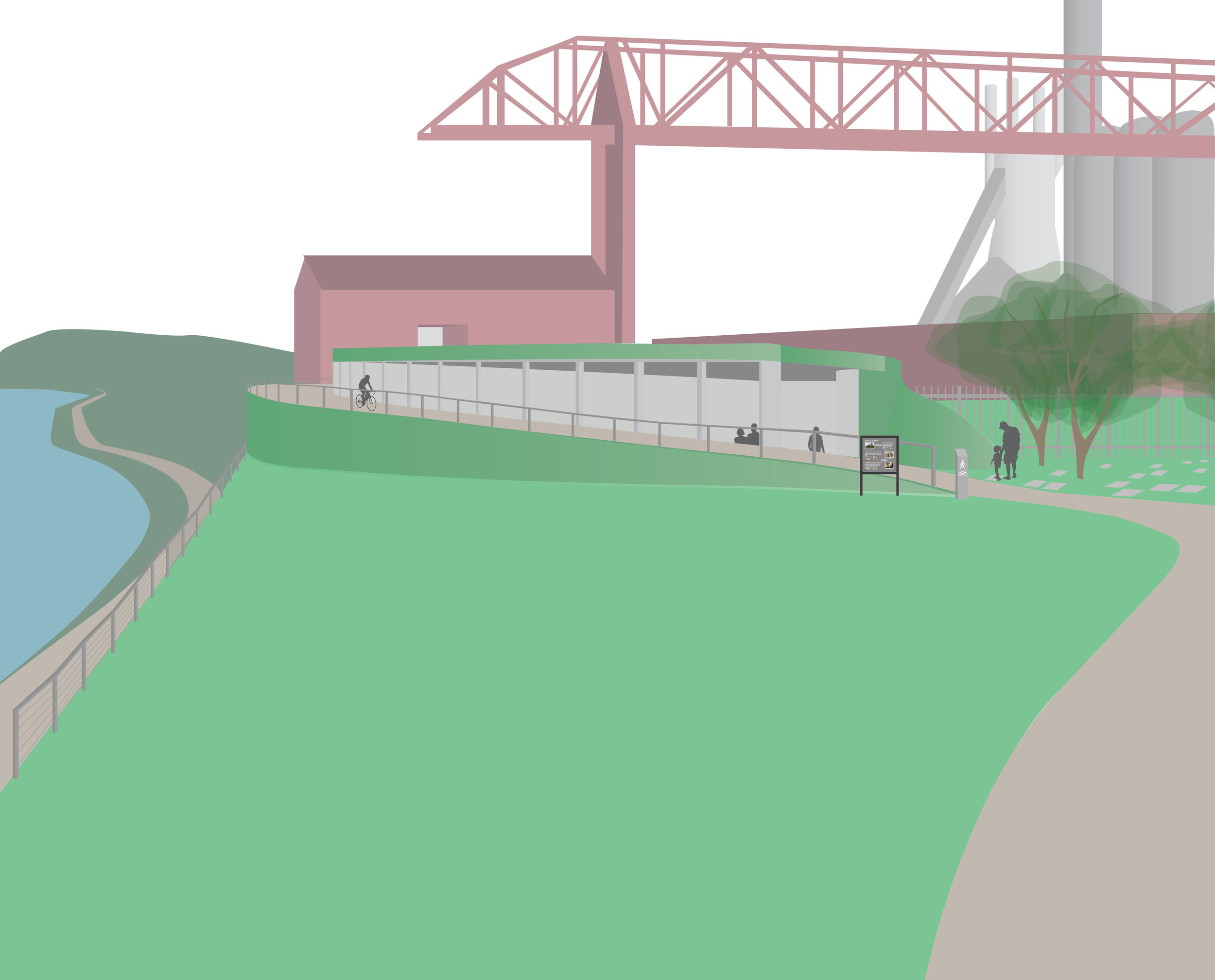
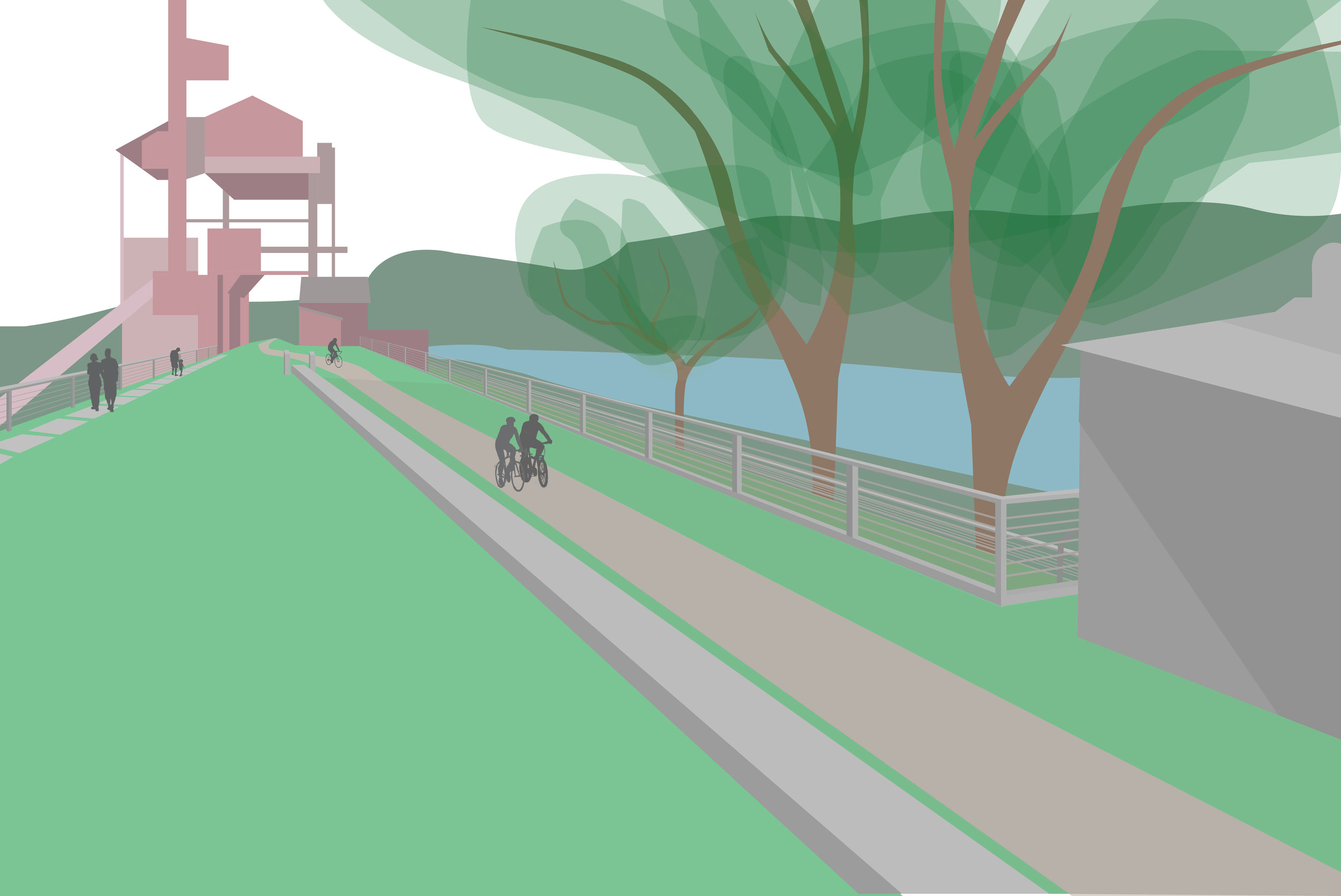
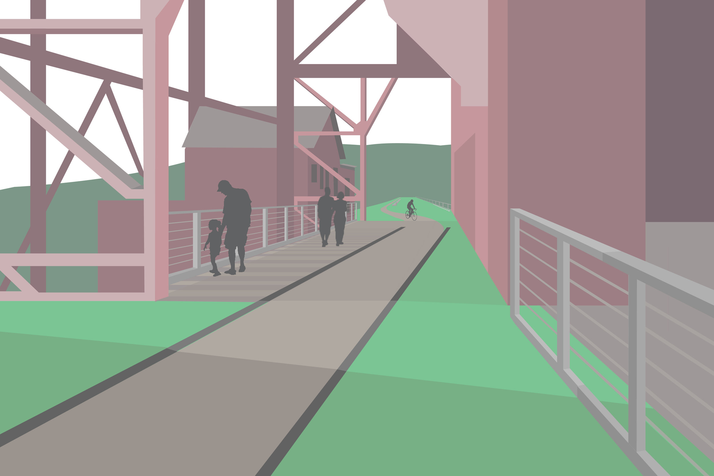
riverfront area, including the bike path, physical and thematic connections to the greater Pittsburgh area, the space outside of the conceptualized Carrie Museum, and the Hot Metal Bridge restoration project (currently not depicted on the map).
After each group presented charrettes, we decided to combine the best and most cohesive parts of our visions and make one overall vision (and thesis proposal) for the site. We focused on the themes of respect, freedom, and discovery, and used spectrums to determine how great our modifications should be, how much information we should provide, and how recreational or educational the experience should be. Each of our six projects are mapped out on the site plan. My project dealt with the

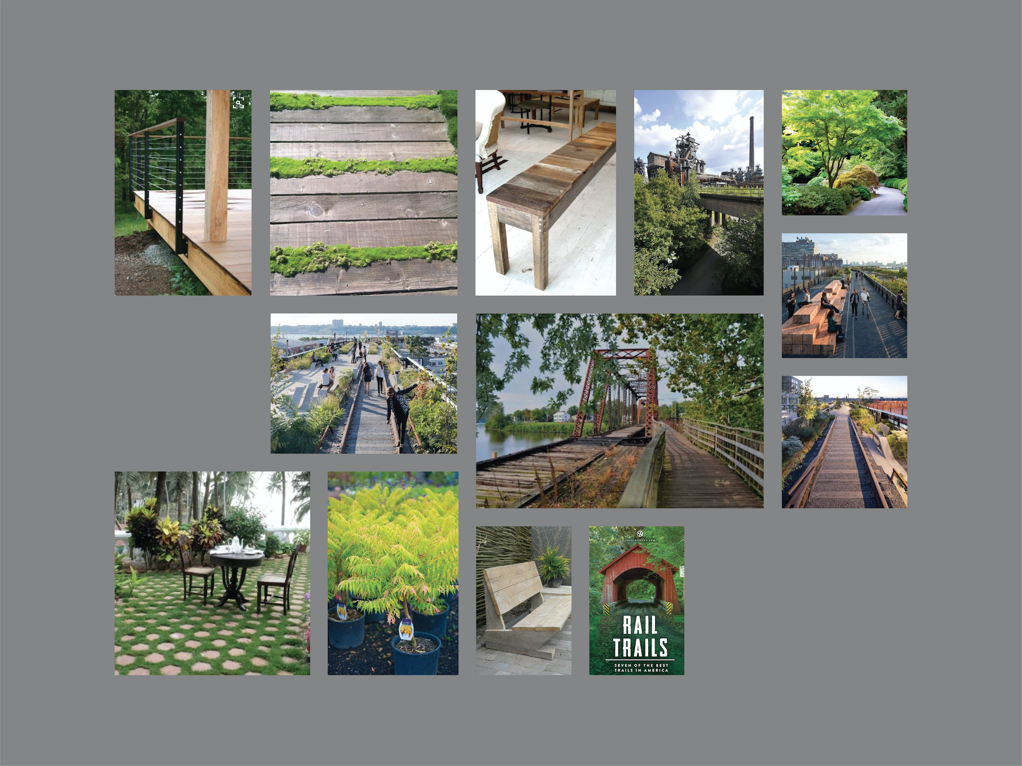
Developing Visual + Textual Language
outside of Carrie Furnaces. The mood board serves as a guide for materials and themes for developing areas around Carrie, such as the railway bike path extension and the piazza area in front of the museum. The wayfinding system will bring people to Carrie, encourage exploration, and spatially designate areas around the Carrie site.
The signage and wayfinding system I created will informationally and spatially connect Carrie Furnaces to its surrounding community. The system will offer useful information, including nearby bike trails, relative distances between sites, information about local programs, eateries, and historical sites, and more. The system ultimately serves as a spatially critical supplement to the information found on the map and in the tourism booklet, and supports my project's overall goal of encouraging exploration within and
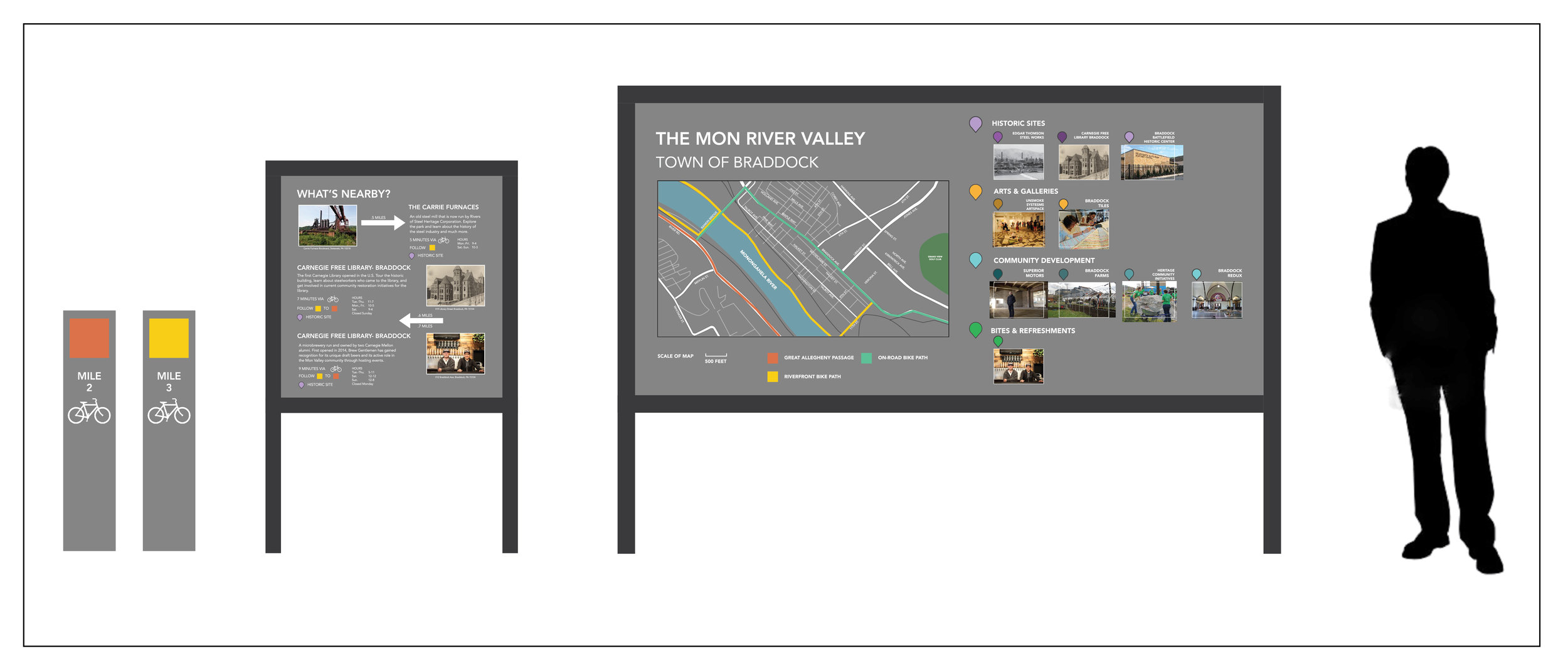
Final Presentation- The Bike Path + Surrounding Area Map
The map intends to geographically connect Carrie Furnaces to the greater community and illustrate the many possible options for commuting to, from, and around the site. One intervention of the bike path system includes extending the path along the Mon River (which Carrie sits on), and connecting this path to pre-existing paths across the river and adjacent to the site.

Includes the Braddock booklet, area map, moodboard, and final presentation board.

Individual Project Boards
and renovation of the site's warehouse which will now serve as an events and workshopping space (farthest). My classmates who created these works include Max Plummer, Ty Van De Zande, Jasper Tom, Ji Tae Kim, and Christopher Perry.
Depicted below are some of the final boards of my classmate's projects, including my own Riverfront and Bike Path poster. Other projects that were developed include an interactive projection installation within our Carrie Museum (second from left), interactive rooms within Carrie that explore scale, materials, and process of making steel (third from left), "exhale locations" which are areas placed throughout the site that encourage individual and reflective thought about one's experience (fourth from left),

The Braddock Booklet
connect Carrie to the greater community and encourage exploration and tourism in the area.
The Braddock Booklet is a tourism guide that I created early on in the individual project phase. Beginning as an artifact that could be found in the Carrie Museum, the booklet became a useful connector between Carrie Furnaces and the greater community. Braddock is a town just under a mile away from the Carrie site. It has close historical ties to Carrie, as many people who worked there and in the Pittsburgh steel industry lived in Braddock. Like the wayfinding system, the booklet intends to thematically and physically

Final Renderings
My main goal for completing this project was to communicate my vision for each space in a clear and understandable way. To do this I created some simple AI renderings that explain the scale, use, and placement of these interventions. They will be the physical spaces that information such as wayfinding can inhabit.